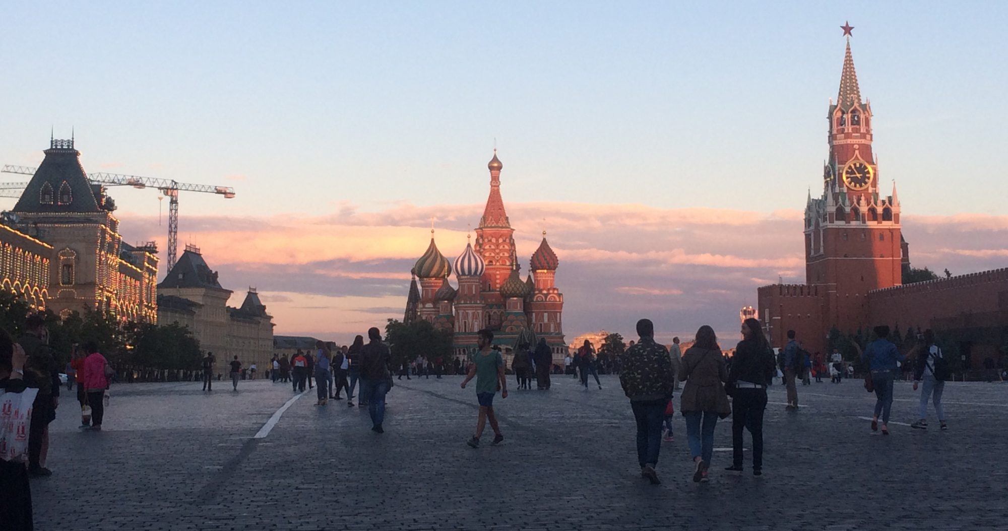
Do you like Cold War era espionage and intrigue? How about mapping and historical geography? Are you a fan of James Bond films? Care to pretend like you are in one? Well, boy do I have the resources for you to realize these fantasies. Two Christmases ago, I was having coffee with a childhood friend, who told me that he had purchased his mother some declassified Soviet military maps for Christmas. This reminded me of an article that I had been sent by a different friend from Wired. Basically, the Soviets engaged in a large-scale map making project for the entire world. A cache of these maps had been discovered in the former Baltic republics of the Soviet Union. Enterprising locals, some of whom had a fair amount of disdain towards the Russian government, realized that they could make money selling off these former top-secret military resources.
I’m not sure how my friend came across them, but he did and purchased a few original maps as well as a few reproductions through eBay. The original maps are in wonderful quality, the reproductions not so much. We had coffee and I translated the map key for him. Fast forward to about a month ago, another good friend showed me a review of a book called The Red Atlas, authored in part by one of the subjects of the Wired article, John Davies. It’s the first book to examine the Soviet military maps in depth. I altered my friend to the book, and he in turn gave me the information for the eBay store from which he purchased his maps.
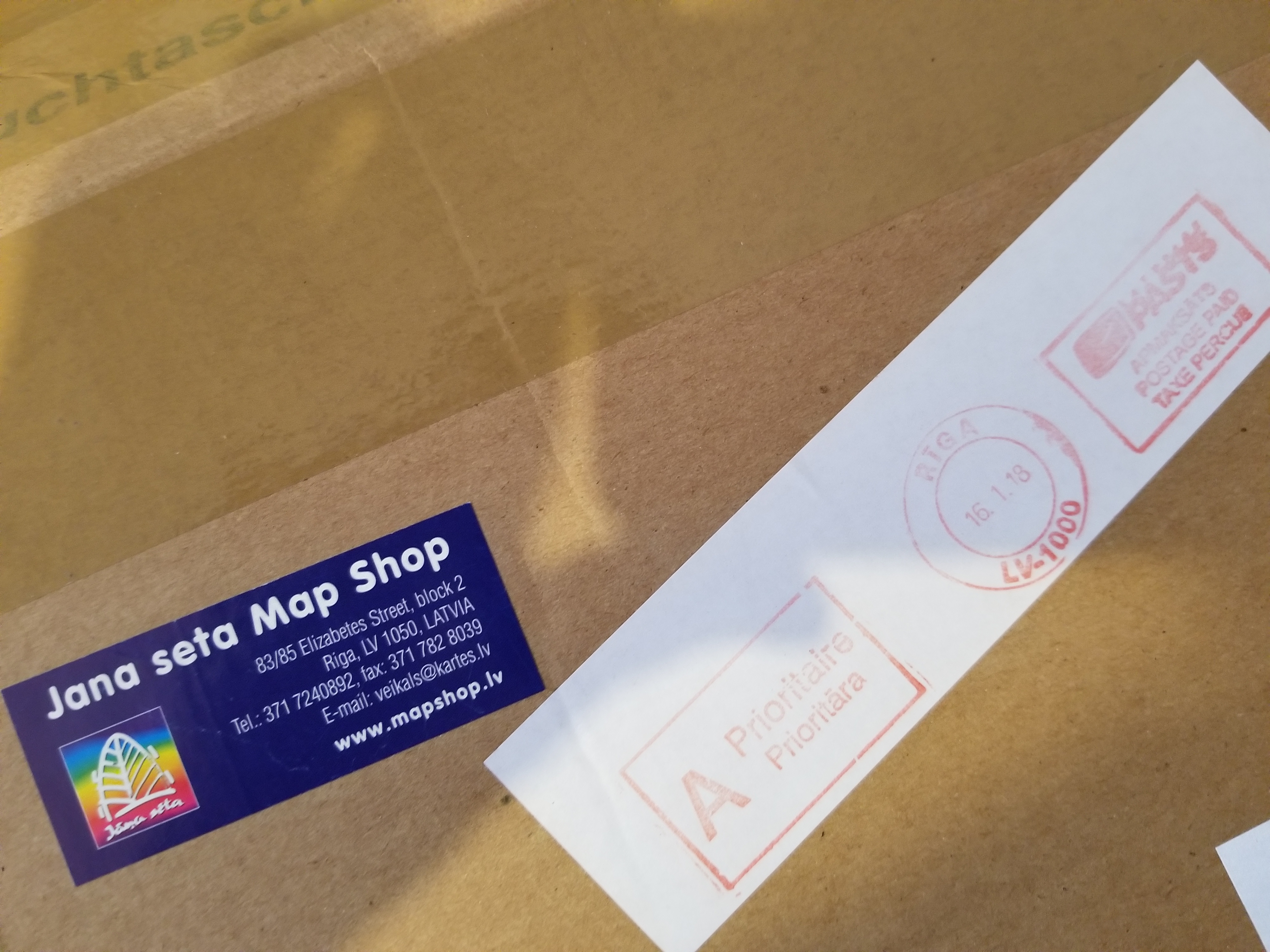
Being a bit of a mapping nerd these days, I was ecstatic to see that there was a Soviet military map for Boston, its surrounding area, and the Atlantic Ocean. At only $25, I felt compelled to buy the map. Mostly I wanted it for the map of Cape Cod, where I spend most of my time when not required to be at school or gallivanting around Russia. It only cost $5 for shipping from Latvia, and the package arrived four days after I ordered it.
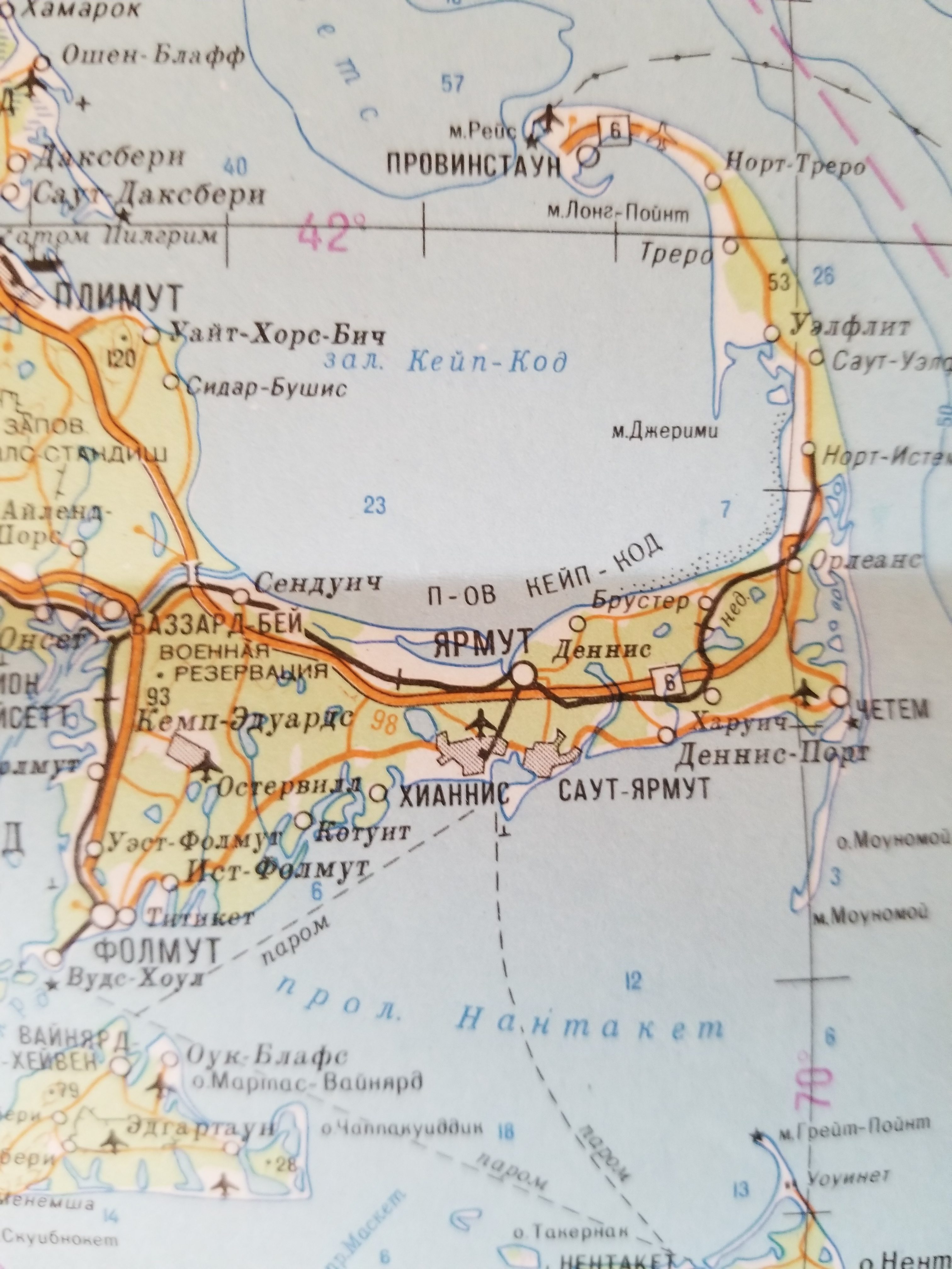
Upon opening the map, I was extremely happy to see the level of detail that the Soviets had put into the map. Chatham Light House was there, as is CQX, the tiny municipal airport that can only service propeller planes. Naturally, the Hyannis Airport was on the map, as is Camp Edwards and its Otis Air Force Base.
Luckily for me, my university library had just ordered a copy of Red Atlas, which I was happy to check out. The book itself is a Soviet history nerd’s dream. The cover states совершенно секретно (sovershenno sekretno, top secret). The majority of my archival sources were generally stamped with this, so it’s a phrase that I’m always interested to see. Indeed, as Davies and Kent note in their book, there were different maps, which had different scales, details, and levels of secrecy. Thankfully, this book includes handy keys to decipher the military maps. Using the key with my Boston map, I’m able to discern quite a lot more from the map than just how the Soviets tactically analyzed the area from which I come.
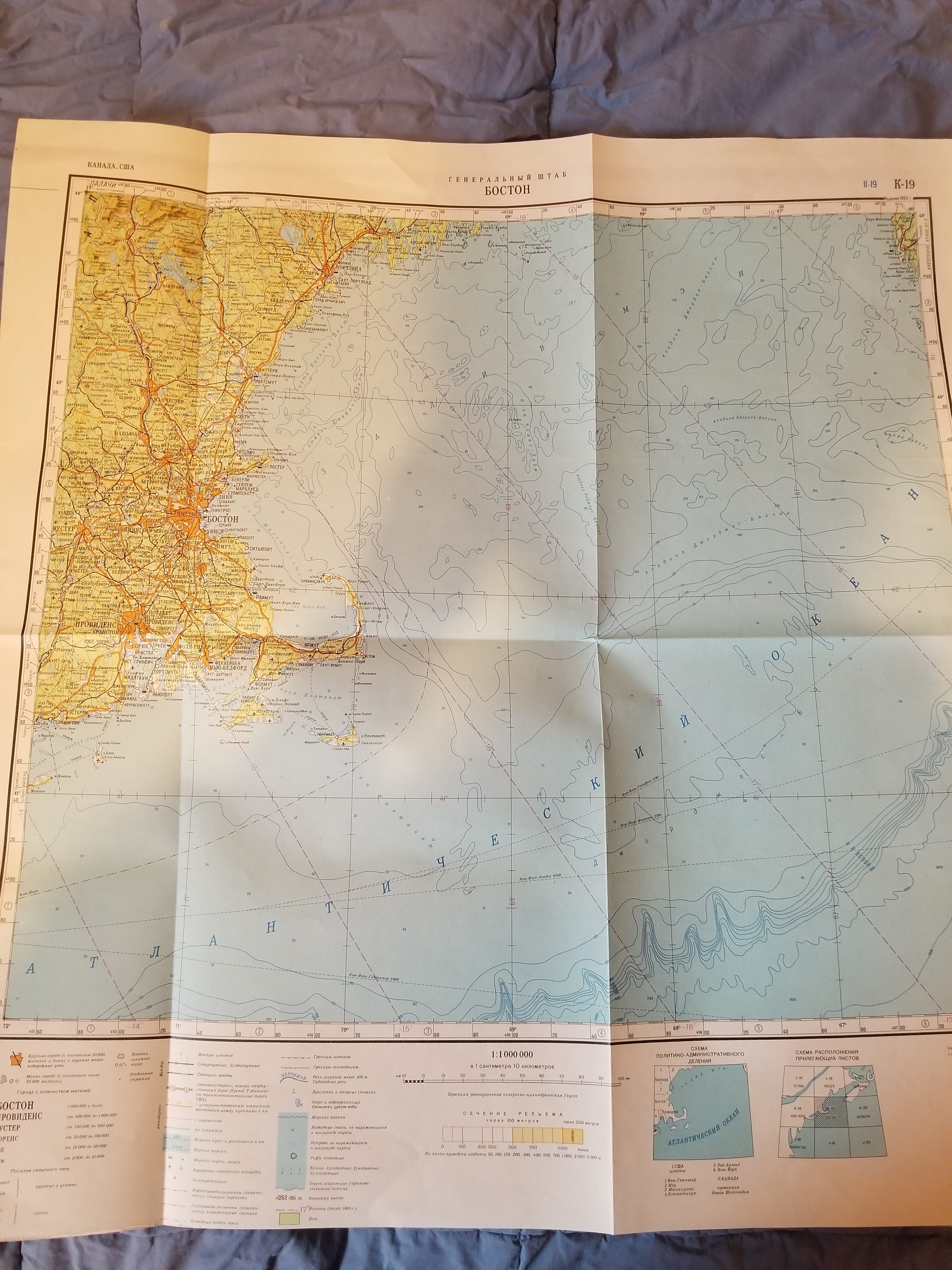
Knowing Russian, I am able to read from the map that is from the 1986 iteration of mapping, though the map itself was printed in 1993. With a quick Yandex (the Russian Google) search, I was able to decipher the acronyms of the publisher. The map says that it was published by the Military Topographic Directorate of the General Staff with the original information from the Main Directorate of Geodesy and Cartography of the Council of Ministers of the USSR. I know that the scale is 1:1,000,000. According to Red Atlas, this means that my map was a small-scale/general terrain evaluation map, which was an unclassified map. The book also gives me a better understanding of where the map was printed. My particular map was printed in December 1993 with a factory code of И (or I) for Irkutsk, a major city in Siberia.
TL;DR – Soviet military maps are cool. You can buy them online, and there’s a nifty book that explains the maps and the massive efforts it took to produce them, an undertaking that was and still is shrouded in mystery.