Here are some drafts of the mapping work that I do for my research. The screenshots below illustrate the iterative nature of my mapping. As I have explained in my article “Beyond the Archive,” the first generation of automated retrieval of camp locations with R was incredibly flawed. I had to work on a script with Python, which was revised a few times, to increase the accuracy of the automated location retrieval. No automated process is perfect, and this type of research still requires a human expert to intervene and correct the results. The map series below shows the subsequent locations of the Python automation and then a revised map based on the Python code.
The source for the camp locations is an encyclopedia of German POW camps in the USSR from 1941 to 1956, which was produced by a joint Russian-German research team. The encyclopedia is wholly based on the collections of the Russian State Military Archive (RGVA). ¹
This section of my website serves to illustrate samples of the evolution of my mapping work. It does not full discuss the results of the mapping, though. I direct those interested in this research to consult my other publications:
“Digital Spatial Methods for Soviet-German History: An Investigation of German Prisoners of War in the Soviet Union, 1941-1956.” In Zeitschrift für Ostmitteleuropa-Forschung. Journal of East Central European Studies. Forthcoming.
“Applying Digital Methods to Forced Labor History: German POWs During and After the Second World War.” In Rethinking the Gulag, edited by Alan Barenberg and Emily Johnson. Bloomington: Indiana University Press. Forthcoming.

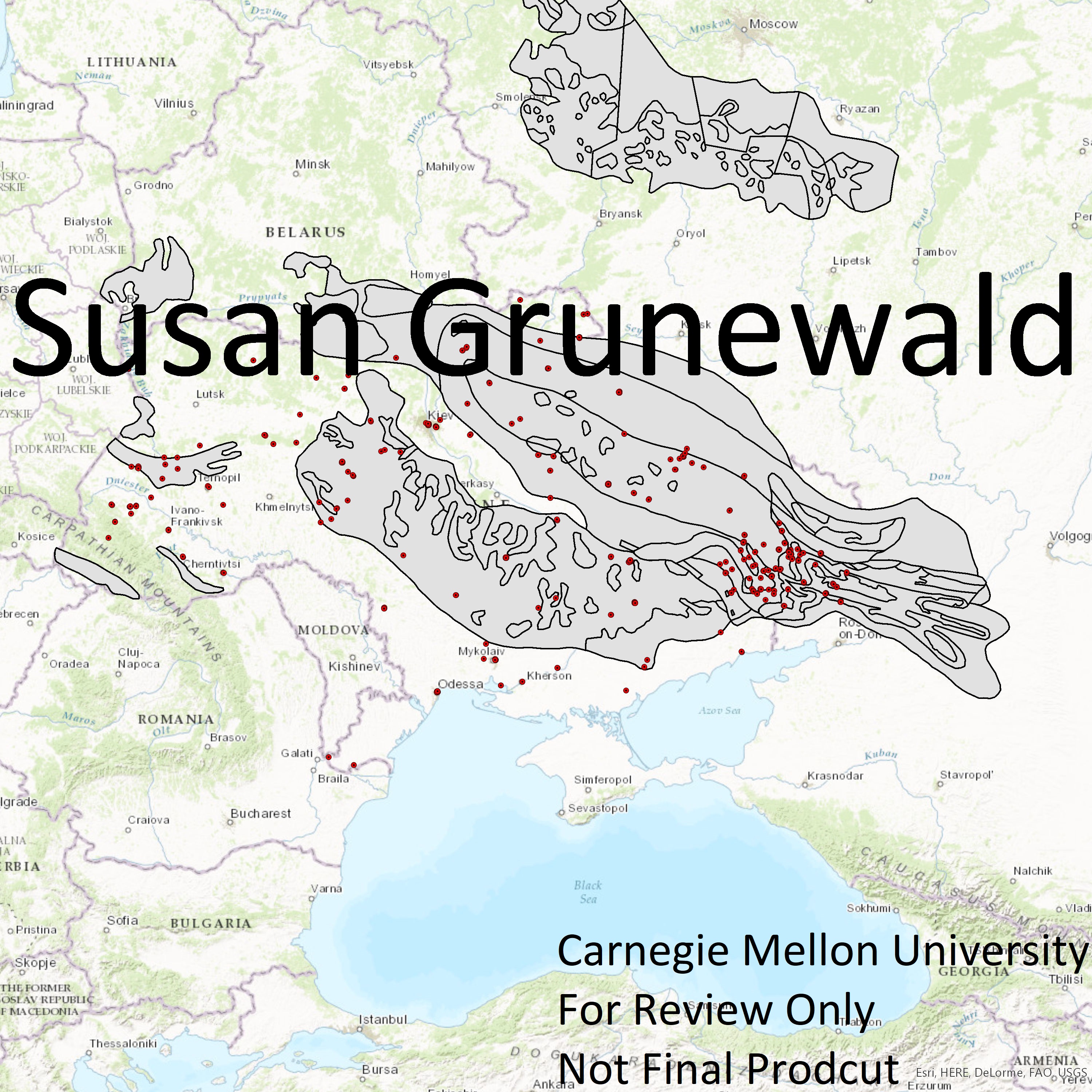

German POW Camps in the USSR, 1941-1956. Stage 2: Automated location retrieval with R-Studio and ggplot and ggmaps.
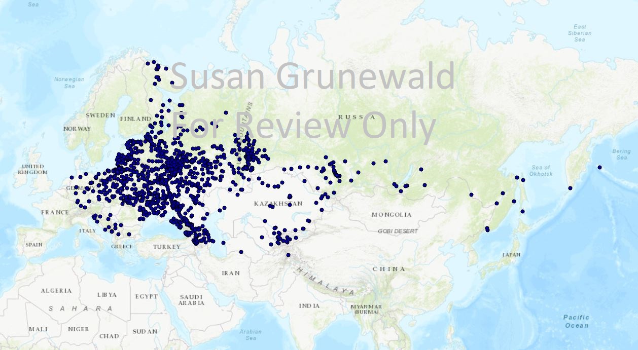
German POW Camps in the USSR, 1941-1956. Stage 3: Automated location retrieval with Python.
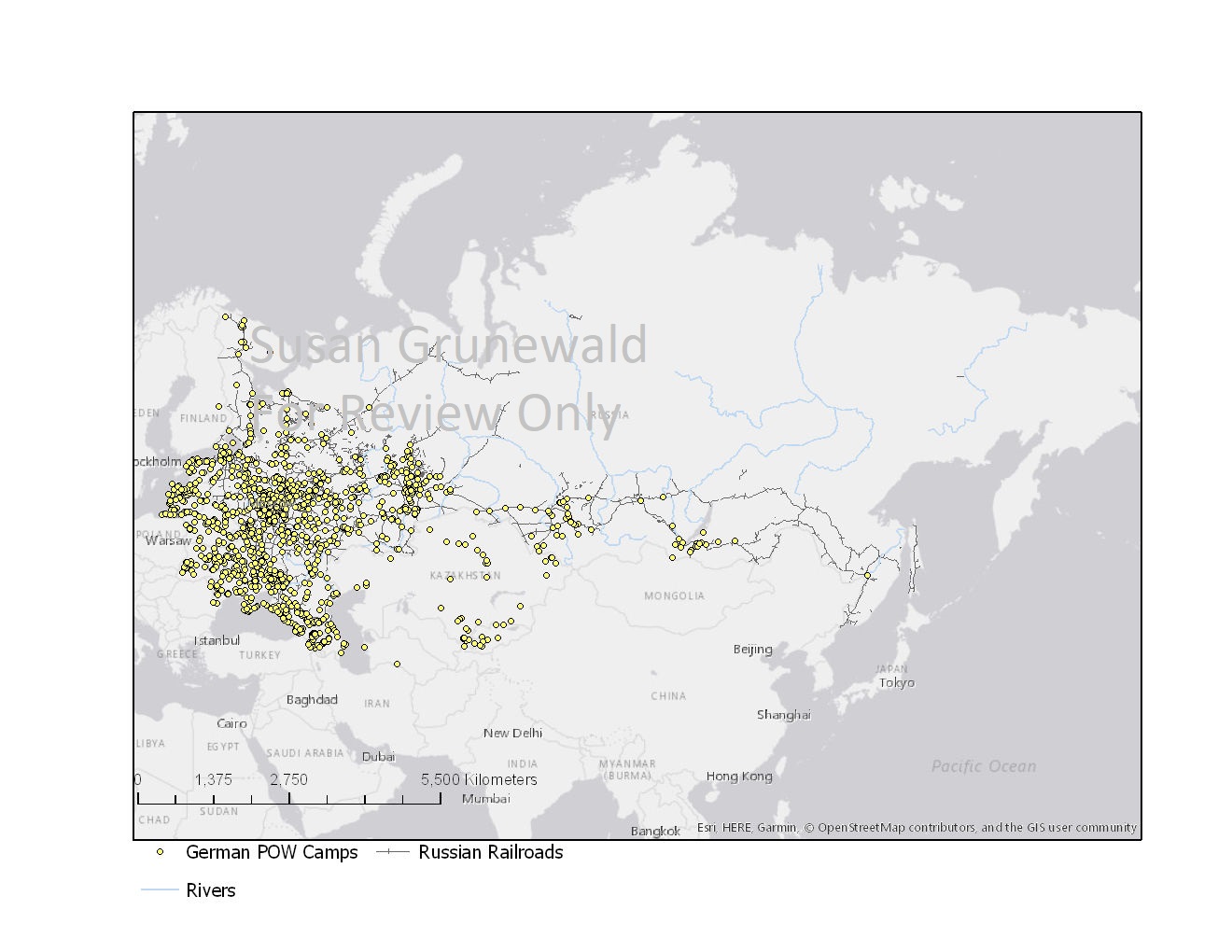
German POW Camps in the USSR, 1941-1956. Stage 4: Fixed Python automatic retrieval. ³
¹ Data set for the locations of camps comes from Veronika Chvatova et al. Orte des Gewahrsams von deutschen Kriegsgefangenen in der Sowjetunion (1941-1956): Findbuch ; [Standorte von Kriegsgefangenenlagern, Arbeitsbataillonen, Friedhöfen sowie Einrichtungen des Frontlagernetzes ; auf der Grundlage von Dokumenten der Kriegsgefangenenverwaltung aus dem Staatlichen Russischen Militärarchiv]. Dresden: Stiftung Sächsische Gedenkstätten zur Erinnerung an die Opfer politischer Gewaltherrschaft, 2010. The publication lists only the nearest city or village of each camp. The geocoding for this stage was a combination of the Batch Geocoding Tool and manual checks through Google Maps.
² Coal basin data is from Michael Brownfield et al., “Coal Quality and Resources of the Former Soviet Union: An ArcView Project,” last modified 2001, https://pubs.usgs.gov/of/2001/ofr-01-104/readme.htm.
³ The rail infrastructure lines comes from “Russian Rails,” http://webarchive.iiasa.ac.at/Research/FOR/russia_cd/download.htm#download.