It’s a new year and I’ve got a cool HASTAC Fellowship, so I’ve decided to add a blog component to my website to occasionally write about cool stuff related to my research, digital humanities, and mapping. I’ll be kicking this all off with a somewhat personal post. Those who have followed my personal travel blog from Russia might know of my brush with fate and how I was able to reconnect with part of my family that we hadn’t really been in contact with since my grandmother, her sisters, and her parents were evacuated by the British during the Russian Civil War. At least one member of my grandmother’s mother’s family remained in Simferopol, Crimea, and became a known Soviet poet, one who was the first to witness and write about the Holocaust. There’s actually a fantastic book written about him. I last saw his daughter in Moscow in July and again in October of 2017.
After my grandmother, her parents, and her sister came to America, my great-uncle was born. He passed away about a year ago and my father brought us some of the pictures and letters, which he had kept from his parents. It seems that my grandmother’s father’s family remained around present-day Ukraine. Some stayed in Kiev, others in Berdichev. Being a historian and the only living member of the family that speaks Russian, I was intrigued to look at the photos and letters. However, it soon became apparent that my knowledge of the history would become depressing.
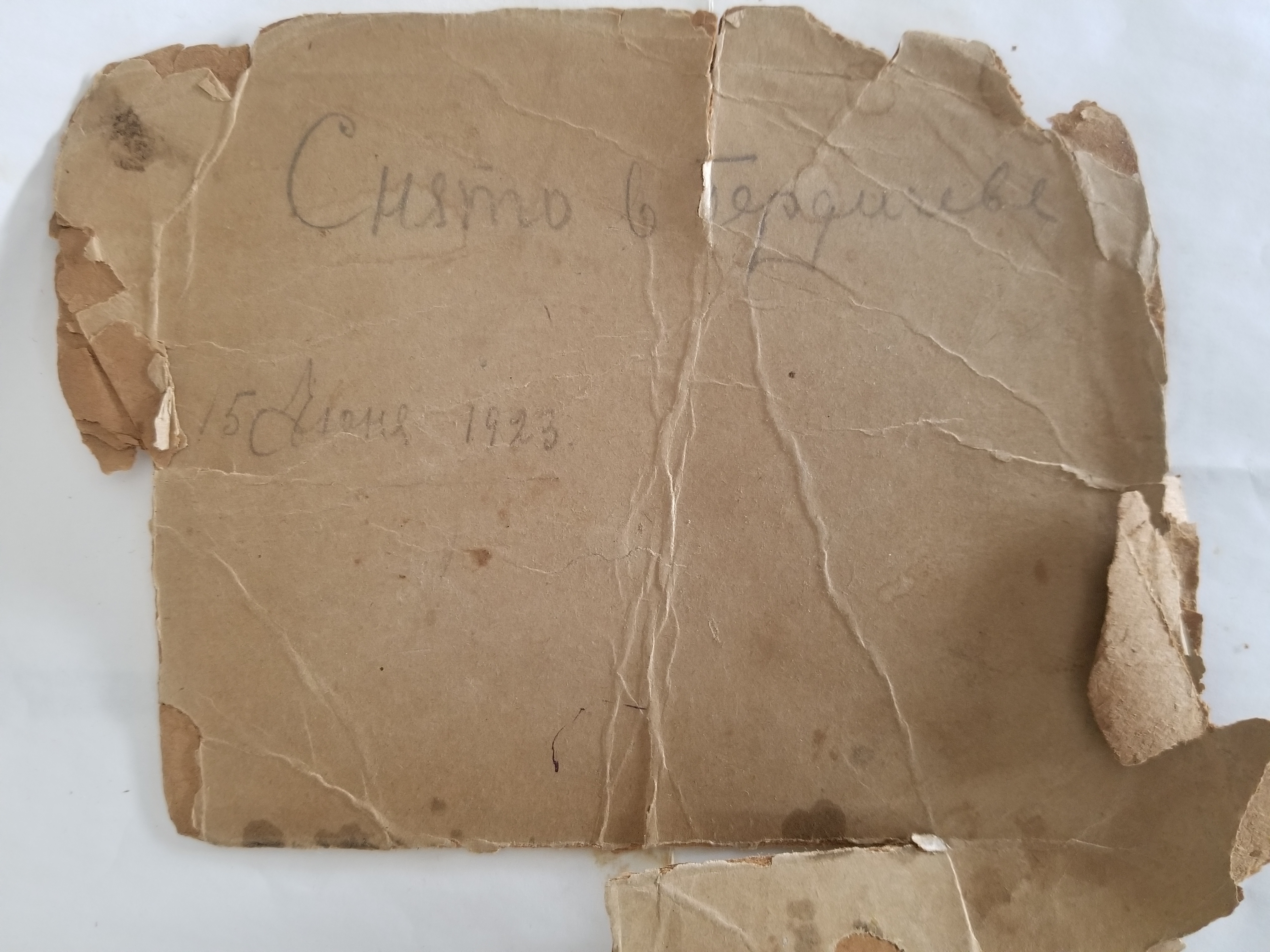
One of the items that was most shocking was a photograph of the extended family. The bottom of the photo has a caption saying that Isaac was killed at the factory. The back of the photo, though, was much more troubling. It says that it was taken in Berdichev in 1923. Upon reading that, I immediately had a pit in my stomach. Berdichev was one of the major sites of the Holocaust, where the majority of the city’s Jewish population was exterminated. It is highly likely that all of those pictured perished.

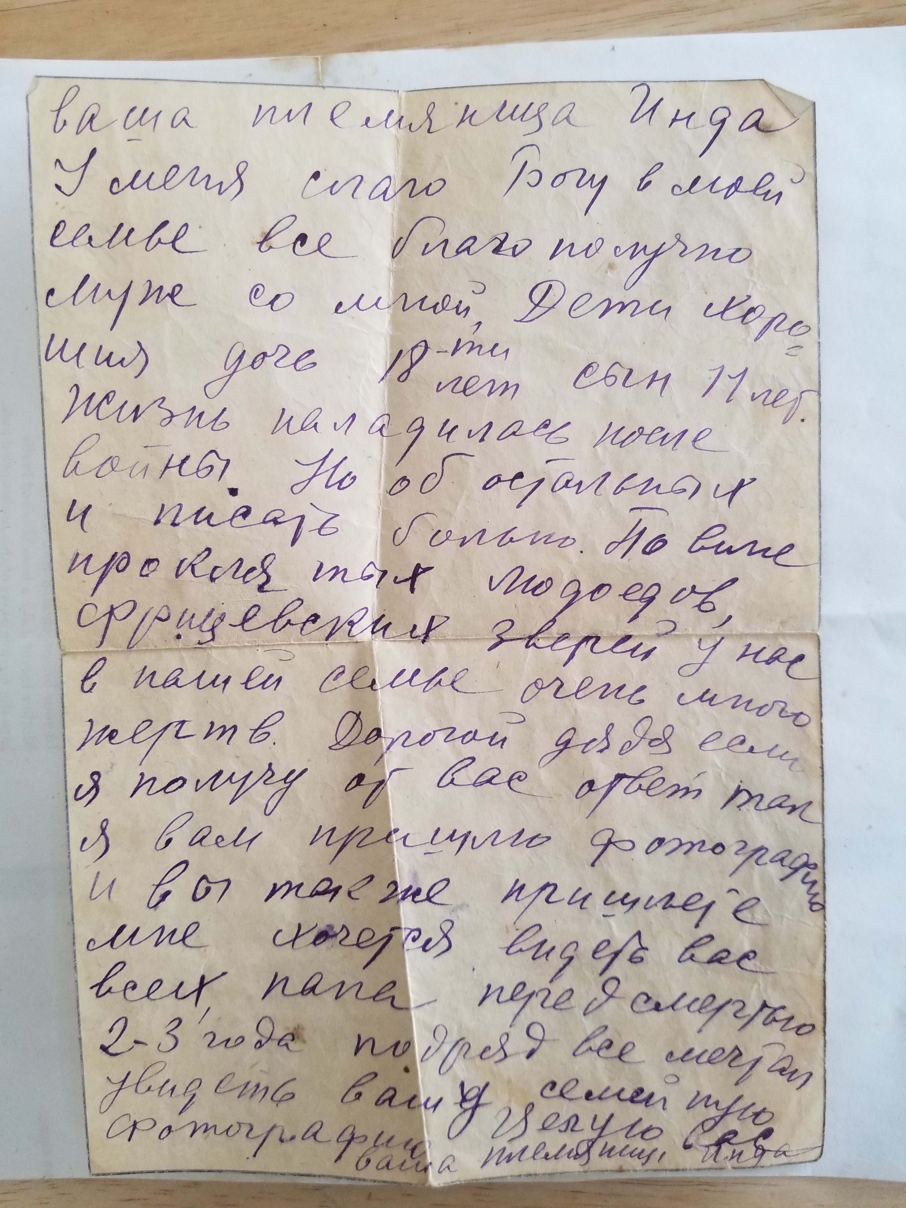
A subsequent letter from 1948 between my great-grandparents and one relative from Kiev alludes to the toughness of the war. The author, Inda, notes that she had received a letter two years before, and only just found the time to write back. She states that her family was doing much better after the war, but that “it is painful to write about the others” and that “due to the officer beasts, many in the family perished.” Most in the Western world don’t understand the toll of the Second World War on the Soviet Union. 27 million Soviet citizens perished during the war, 2 million of whom were Jews in the Holocaust. It is not an exaggeration to say that every Soviet family was touched by the war and lost at least one person. While I had suspected some of this, I had never known the extent. Indeed, my own extended family suffered losses during the war.
This brings me to my connection between my personal life and my research. For the past few years, I have worked as a teaching assistant for a course on genocide and weapons of mass destruction. One year, we read Father Patrick DesBois’s The Holocaust By Bullets, which chronicles the Holocaust in Eastern Europe, primarily in the territory of the Soviet Union, beyond the major deathcamps such as Auschwitz or Treblinka. Unlike at those camps, where killing was mechanized and impersonal, the vast majority of the executions in Soviet territories was by cruder, personal means such as shootings. Berdichev was one of these sites. While using Father DesBois’s book, I found out about his interactive mapping project, as I was embarking upon my own work with German prisoner of war camps. I consider Father DesBois’s map of the Holocaust by Bullets to be one of the best interactive mapping projects I have ever come across. In addition to plotting the extermination sites, each location features information from relevant archival sources, either German or Soviet, as well as testimonies from those who remained. Anyone interested in historical GIS, digital humanities, the Holocaust, or the history of World War II should know of this resource. This mapping project quickly and easily conveys the magnitude of the exterminations. It also readily illustrates the human toll of the Second World War on the Eastern Front. More work of a similar nature should be done to visualize the economic and human destruction of the Second World War.